Responding to COVID-19 in Bronx, NY
The Bronx, NY | January 2021
Maps
COVID-19 Response Center (CRC)
1
2
Budgetary Constraints
Due to financial limitations, the city can only establish three CRCs. These Centers are strategically located to provide the most equitable access to Bronx residents based on travel distance. The red lines indicate service areas for each Center.
3
Flexible Access
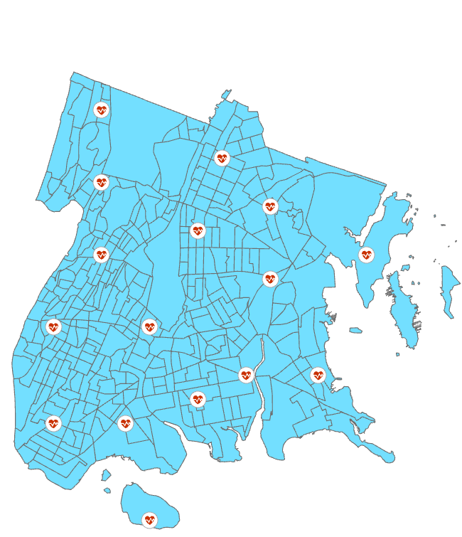
In this scenario, city officials must establish 16 CRCs so that every Bronx resident is able to access a site within a 30-minute walk.
Introduction
Leading up to the COVID-19 pandemic, the Bronx was experiencing strong population and employment growth. Yet, despite these positive trends, most Bronx neighborhoods faced greater risks for negative health and financial outcomes compared to the City’s other boroughs.
From the onset, the Bronx was hit hardest by the pandemic compared to other boroughs. It saw the highest rates of hospitalizations and fatalities, despite not leading in case numbers. And, residents similarly experienced significantly higher rates of unemployment.
Factors including lower household incomes, higher poverty rates, concentrated employment within face-to-face sectors, and a higher share of marginalized folks, made Bronx residents particularly vulnerable to economic stress and heightened difficulty accessing high-quality care.
Data & Methods
This project identifies optimal locations to establish COVID-19 Response Centers in the Bronx. These CRCs serve as emergency facilities where residents can access testing, supplies, and other pandemic-related services.
With data retrieved from NYC Department of Health and NYC OpenData, I use ArcGIS to map optimal CRC locations under various conditions.
Case Count
This map is similar to Scenario #2 with slight contextual changes. The placement of these three CRCs allows for areas with the greatest susceptibility for infection (i.e. highest case counts) to receive care. The red lines indicate areas of greatest need.


